
The first five maps indicate all spray events (shown in red) that have occurred from 2014-2017 in cities along the South coast. The final two maps show only spray events in 2017 (click image to enlarge).
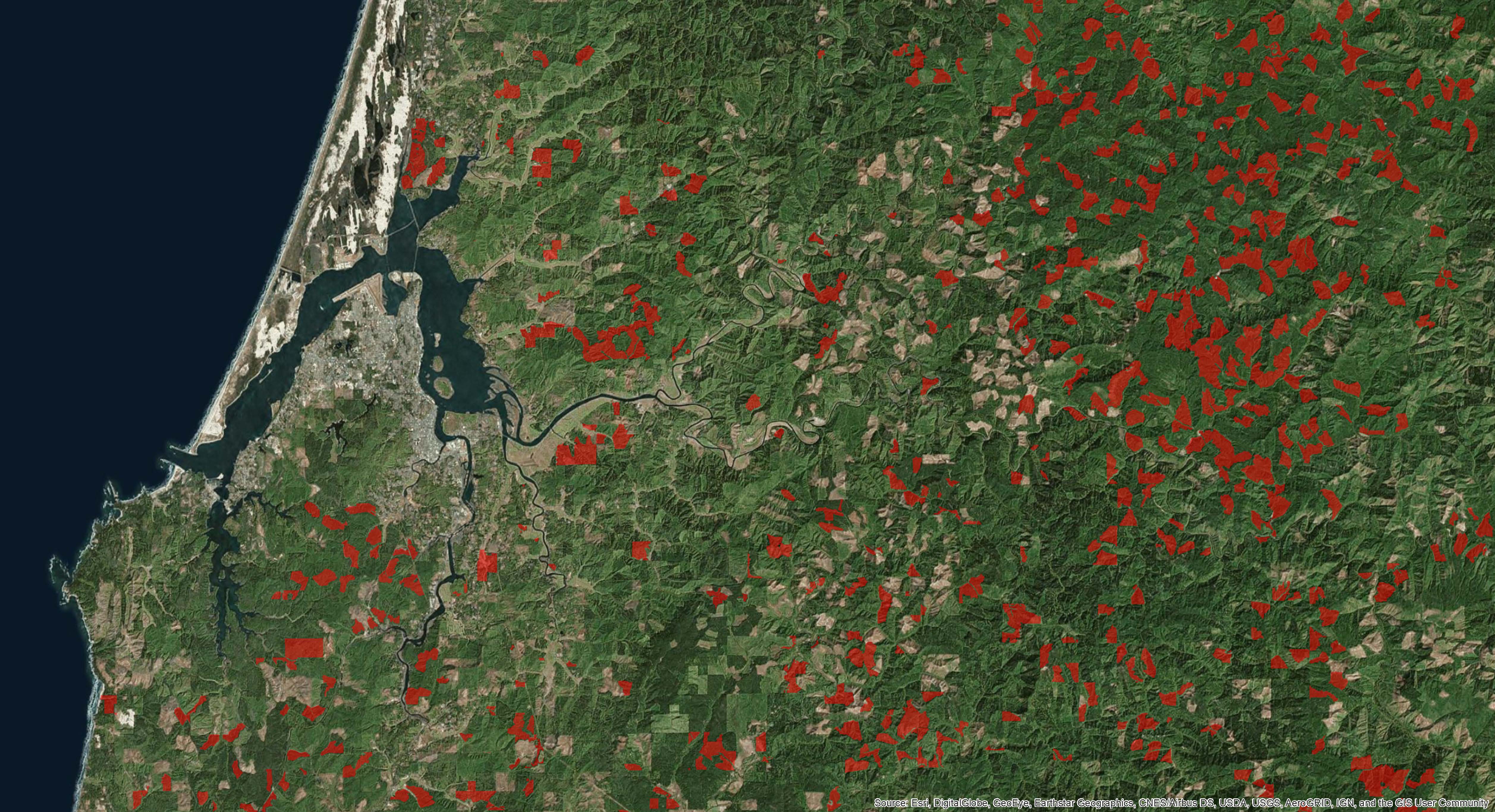
Coos Bay Area
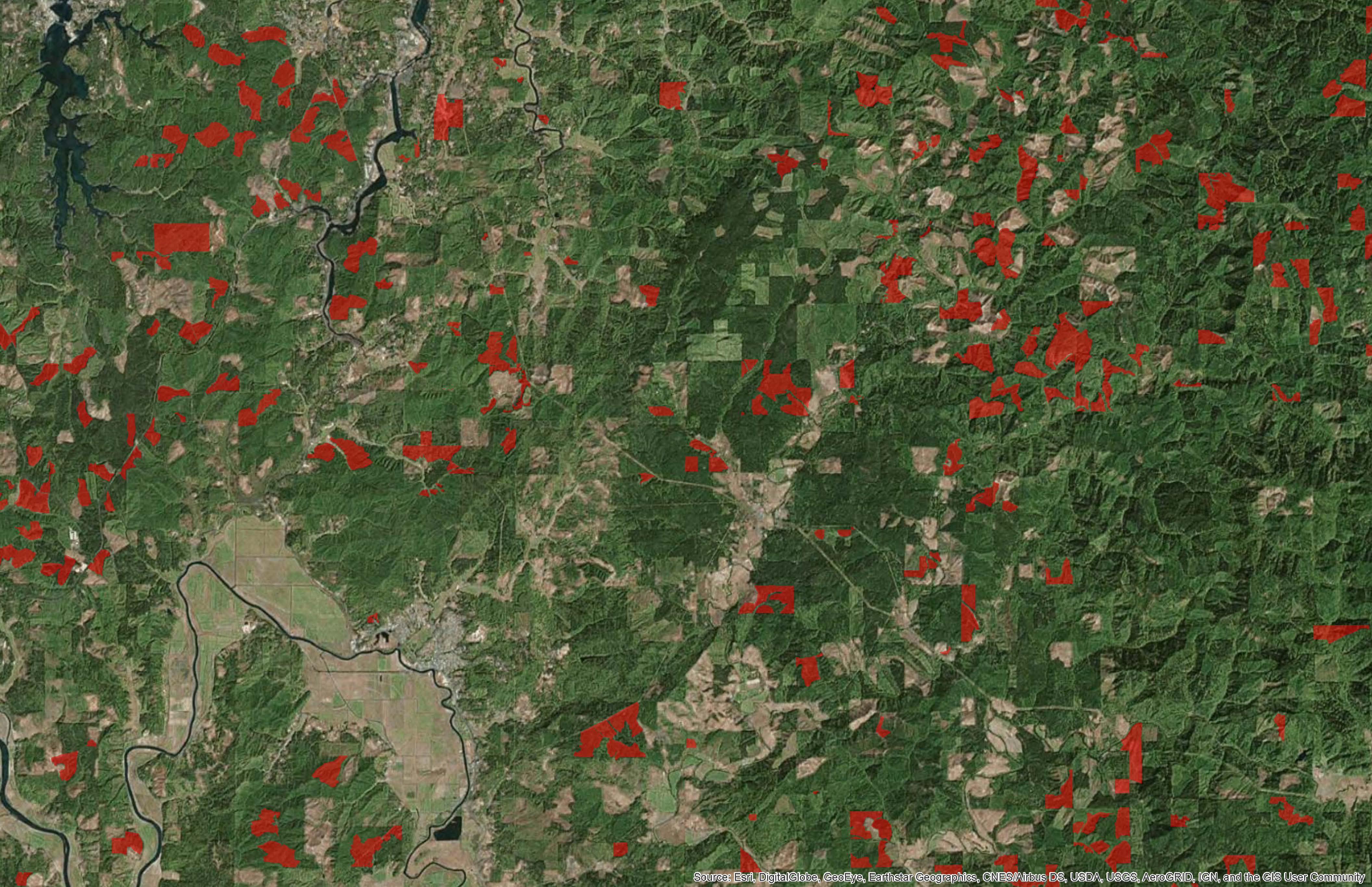
Coquille Area
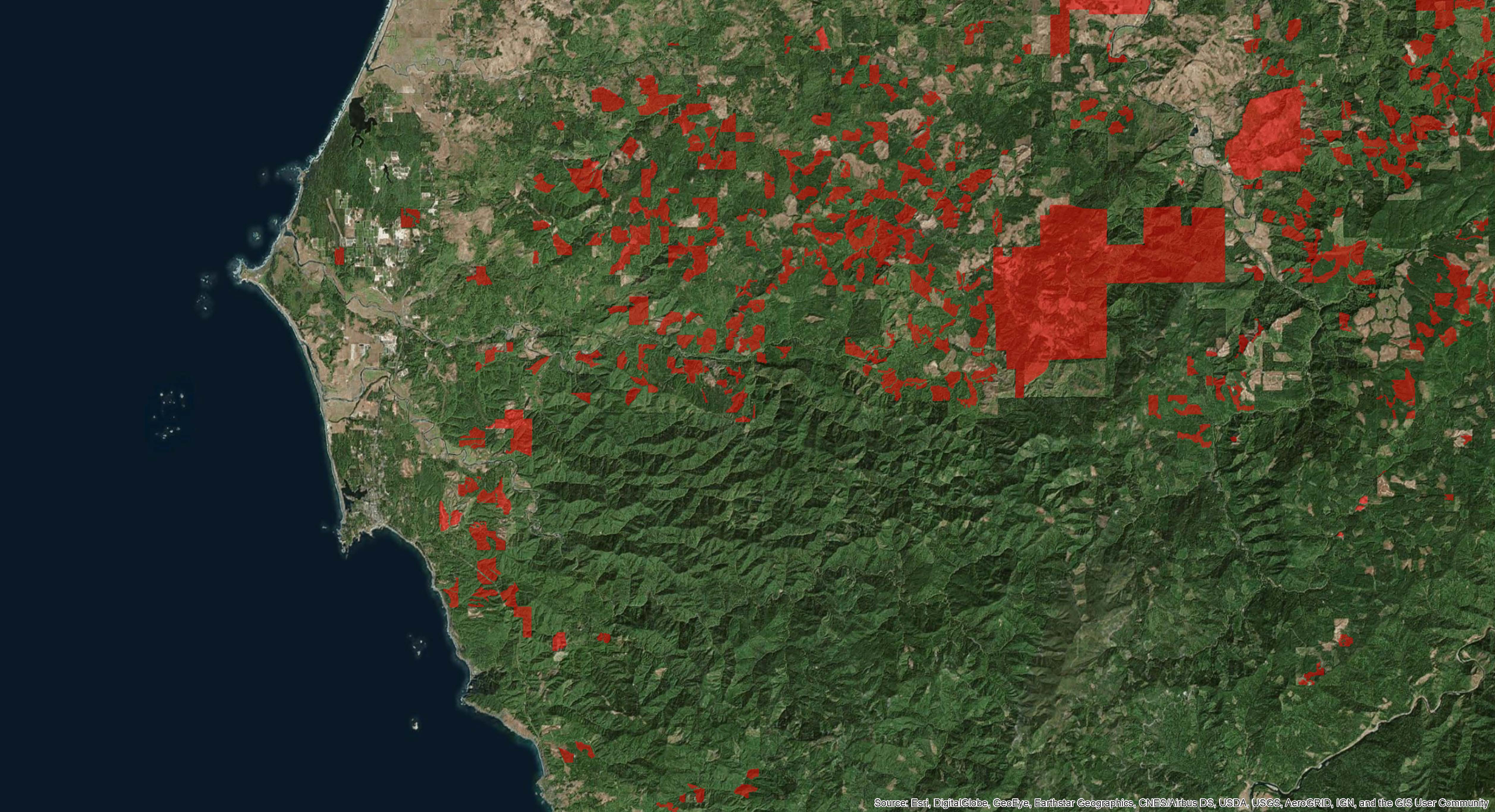
Port Orford Area
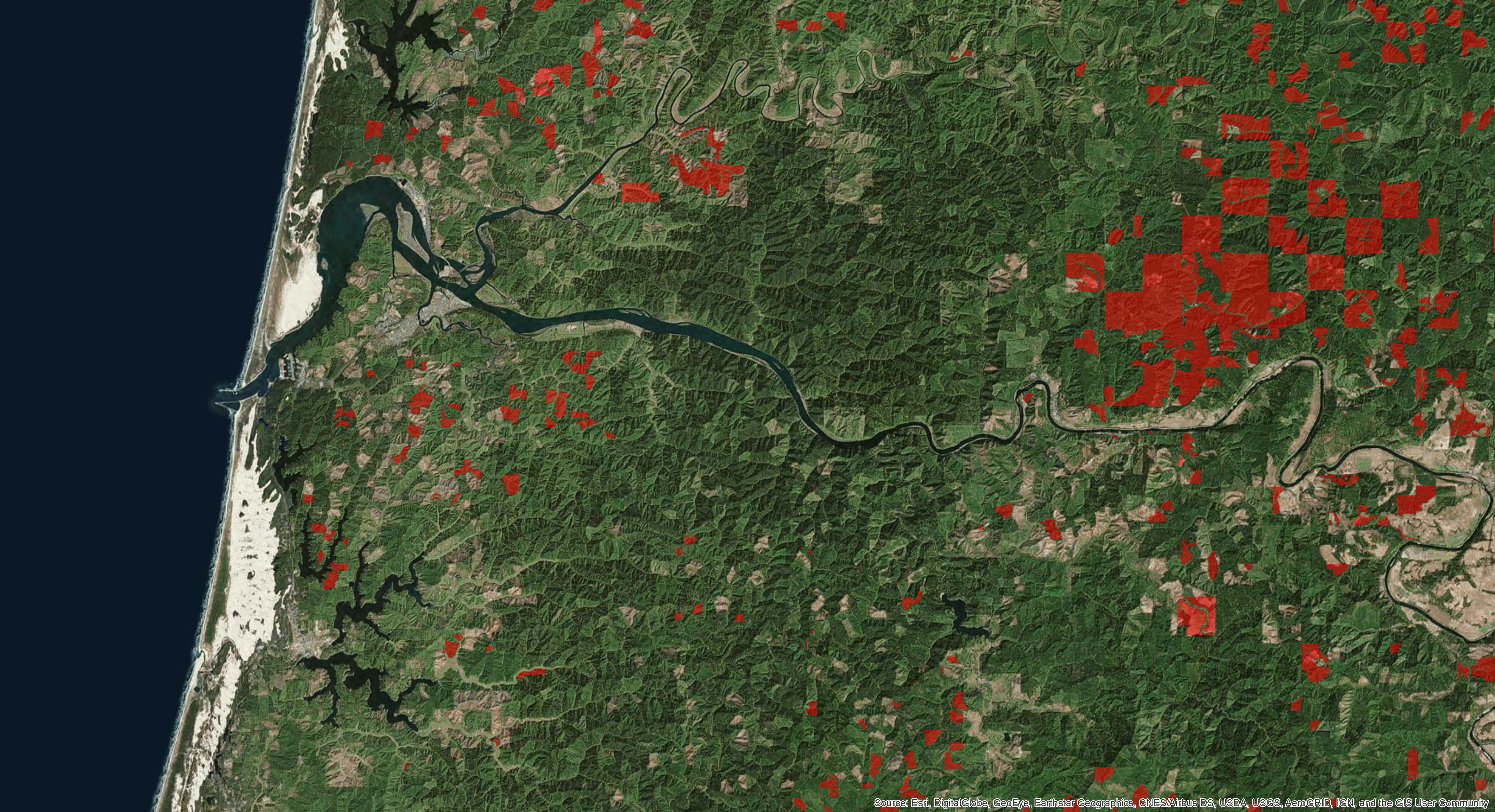
Reedsport Area
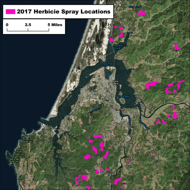
Coos Bay Area – Only aerial herbicide sprays by forestry

Coquille Area – Only aerial herbicide sprays by forestry
These maps were created using public data that is available for download on the ODF “Maps & Data” webpage.

